

Abstract
We compiled existing seismic, gravity, radar and magnetic data together with the subglacial bedrock relief from the BEDMACHINE project to build the first detailed sediment model for Antarctica. We interpolate this data according to a tectonic map of Antarctica using a statistical kriging method. Our results reveal significant sediment accumulations in Antarctica with several types of sedimentary basins: parts of Beacon Supergroup and more recent rifting basins. The basement relief closely resembles major geological and tectonic structures. The thickness of sediments has significant variations around the continent and depends on the degree of crustal extension. West Antarctica has wide sedimentary basins: Ross basin (thickness 2-6 km), Filchner-Ronne basin (2-12 km) with continuations into East Antarctica, Bentley Subglacial Trench and Byrd basin (2-4 km). The deepest Filchner-Ronne basin has complex structure with multi-layer sediments.
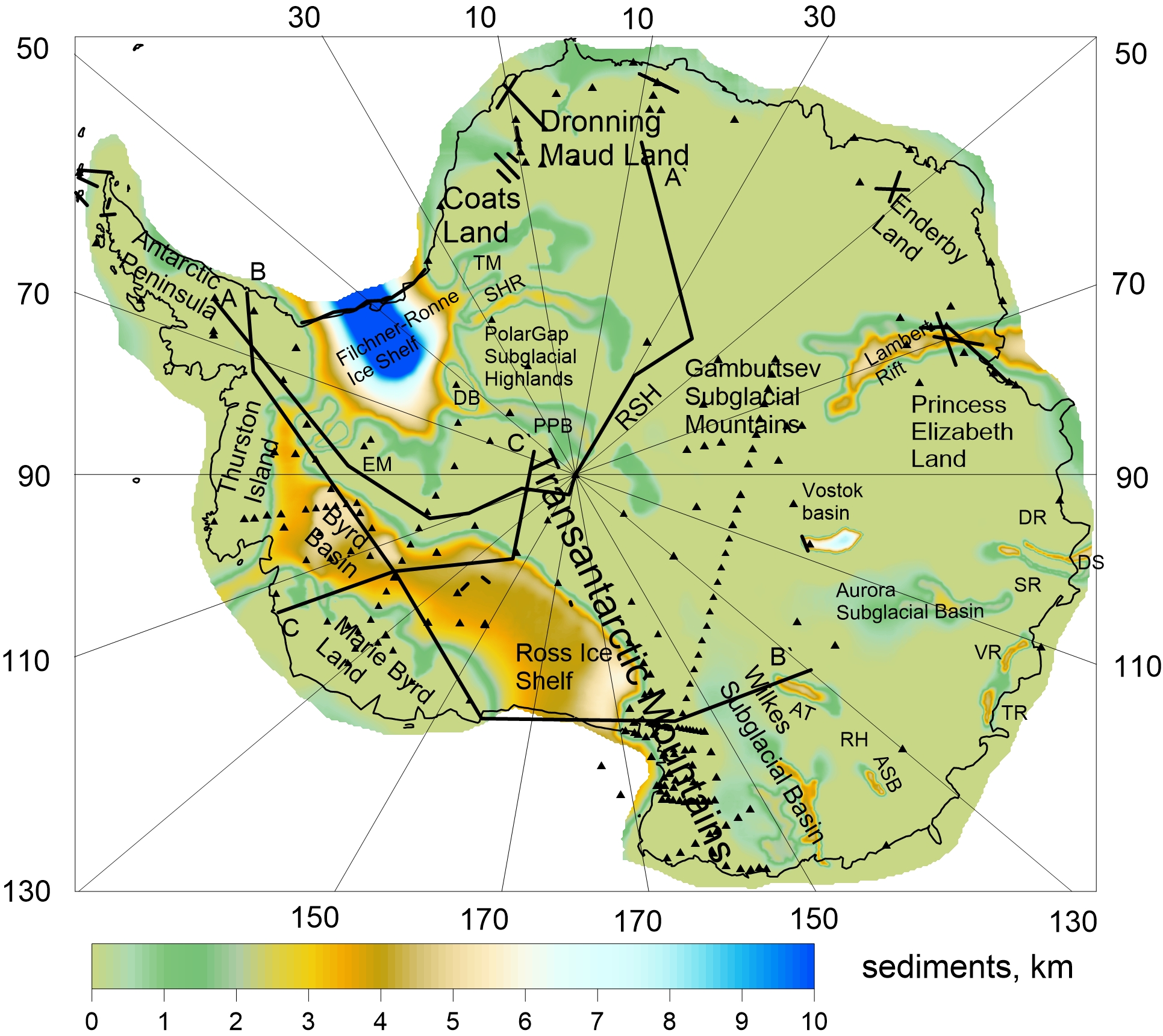
East Antarctica is characterized by both vast sedimentary basins such as Pensacola-Pole basin (1-2 km), Coats Land basins (1-3 km), Dronning Maud Land basin (1-2 km), Vostok basin (2-7 km), Aurora basin (1-3 km), Astrolabe basin (2-4 km), Adventure basin (2-4 km), Wilkes basin (1-4 km) and narrow deep rifts filled by sediments: JutulStraumen rift (1-2 km), Lambert rift (2-5 km), Scott, Denman, Vanderford and Totten rifts (2-4 km). Average thickness of sediments for the whole continent is about 0.77 km. The new model, ANTASed, provides significant improvements over CRUST 1.0 for Antarctica and reveals new sedimentary basins in comparing to CRUST 1.0 model. Differences between ANTASed and CRUST 1.0 reach +12/-3 km. Data file.