

Seismotectonic processes of the Shillong Plateau (SP) have been influenced by the Himalayan orogeny, the India-Burmese subduction, and the Bengal Basin evolution leading to high seismic activity in the region. A probabilistic assessment of the seismic hazard of the SP was carried out in order to provide scientific information to the engineering and disaster risk management communities. Seismic hazard analysis is used to determine ground fluctuations in densely populated areas of the SP and, in particular, in the cities of Shillong, Nongpoh and Tura. This analysis is based on the use of historical and instrumentally recorded regional earthquakes since 1411 and deals with uncertainties related to earthquake magnitudes, rupture locations, and the frequency of ground motion exceedance.
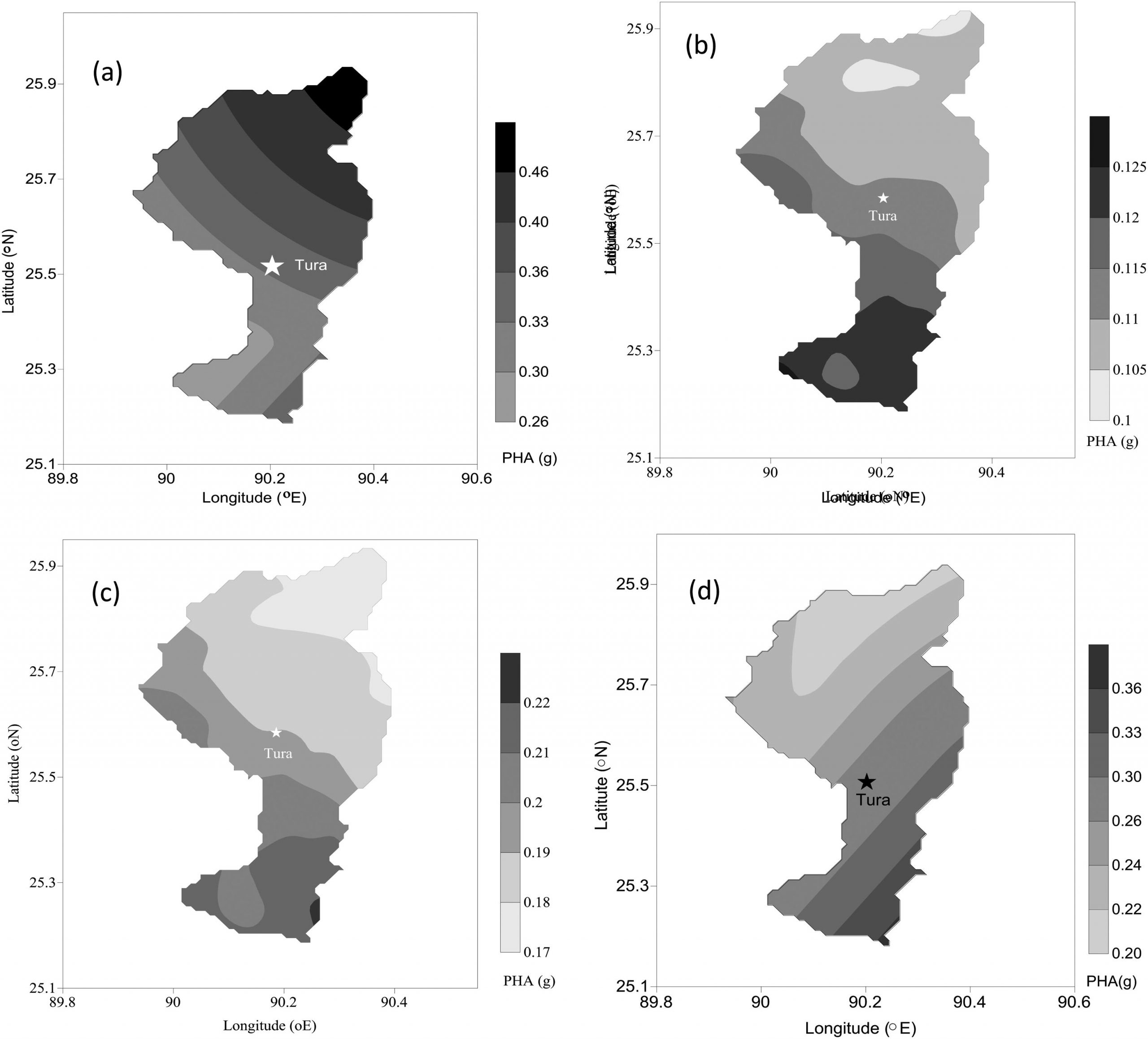 Figure shows hazard maps for the West Garo hills: (a) DSH assessment map, (b) PSH assessment map for 10% probability of ground motion exceedance; (c) PSH assessment map for 2% probability of ground motion exceedance; (d) DSH assessment map with no contribution of the Oldham fault.
Individual hazard curves indicate that the Barapani fault possesses the highest frequency of seismic hazard for Shillong city and Nongpoh, and the Eocene hinge zone and Dauki faults are responsible for the highest frequency of seismic hazard at Tura. The results of the hazard assessment together with those obtained earlier using a scenario-based approach demonstrate that although the Oldham fault located near Tura can produce a great, but rare earthquake, few other nearby faults are capable of producing smaller magnitude events with a higher probability of occurrence.
The paper was published in the journal Geomatics, Natural Hazards and Risk (Q1, JIF = 3.333)
Source: Baro O., Kumar A., Ismail-Zadeh A. Seismic hazard assessment of the Shillong Plateau using a probabilistic approach // Geomatics, Natural Hazards and Risk. 2020. V. 11. № 1. P. 2210-2238. DOI:10.1080/19475705.2020.1833989